
Paper Maps
Paper Maps
The Jefferson County Office of GIS & Addressing provides downloadable maps for public use. Maps cover a variety of topics, including emergency services, geography, government boundaries, and planning and zoning.
- Maps may be downloaded directly from this page.
- Hard copies are also available for purchase for a nominal fee.
- To request a printed map, contact the Office of GIS & Addressing.
Interactive Maps
The office is converting select popular maps into interactive online resources. As maps become available, the office adds them to the Interactive Maps portal.
Interactive Maps Portal
Choose a Category
Paper Maps
General Information
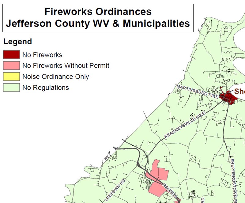
Fireworks Ordinances
This map shows the fireworks ordinances for Jefferson County & local municipalities. The map at full size is 24 x 36 in.
Author
Jefferson County GIS/Addressing Office
Date Published
June 2025
Download PDF Map
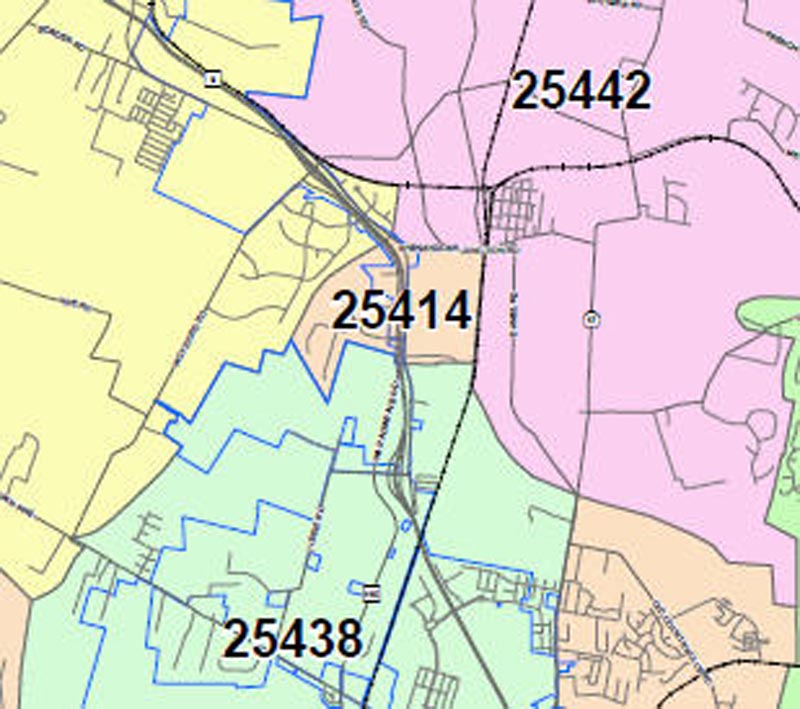
Zip Code Areas – Jefferson County
This map shows the zip code and municipality boundaries for Jefferson County. The map at full size is 36 x 54 in.
Author
Jefferson County GIS/Addressing Office
Date Published
August 2012
Download PDF Map
Regional Parks & Trails – Jefferson County
This is a comprehensive map of parks and trails in and around Jefferson County. Proposed trails are also included. This full-size map is 24 x 36 in.
Author
Jefferson County GIS/Addressing Office
Date Published
June 2025

Download PDF Map
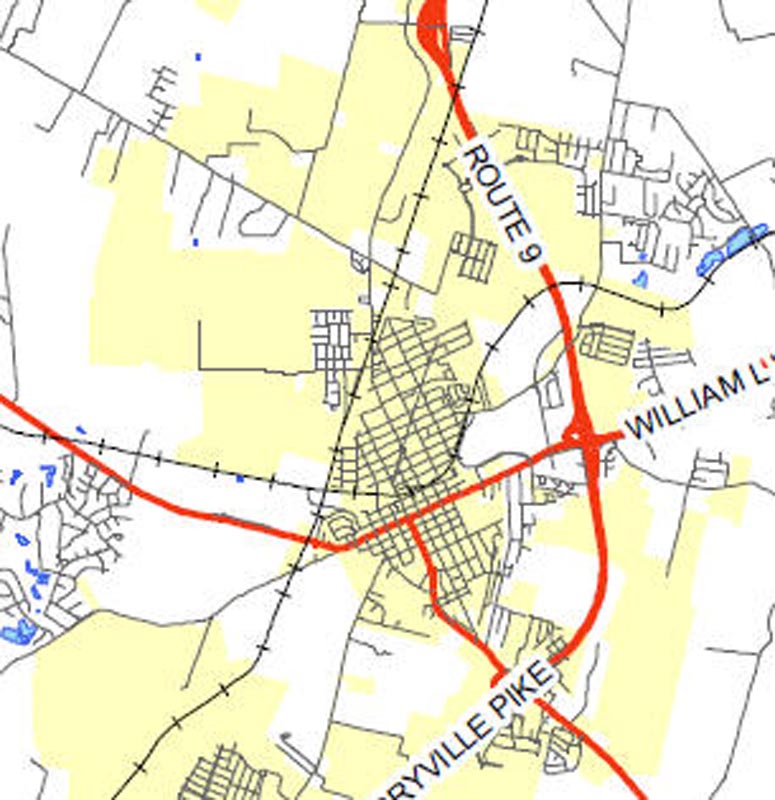
Jefferson County, WV
This is a basic county map featuring only roads, municipal boundaries, and water features. The map at full size is 11x17in.
Author
Jefferson County GIS/Addressing Office
Date Published
October 2016
Download PDF Map
Jefferson County, WV
This is a basic county map featuring roads, municipal boundaries, streams, and water features. The map at full size is 36x54in.
Author
Jefferson County GIS/Addressing Office
Date Published
October 2016

Download PDF Map
General Highway Map – Jefferson County WV
These two maps show the state-owned roads in Jefferson County along with their route numbers.
Author
West Virginia Division of Transportation
Date Published
January 2022

Download PDF Map
Roads of Jefferson County, WV
This is page 1 of the County Roads Map Set. This map shows all the named roads in Jefferson County as of January 2026. Map at full size is 36″x48″.
Author
Jefferson County GIS/Addressing Office
Date Published
January 2026

Download PDF Map
Roads of Jefferson County WV Area Inset Maps
This is page 2 of the County Roads Map Set. This map shows all the named roads in Jefferson County Incorporated Areas plus Shannondale and Keyes Ferry Acres as of January 2026. Map at full size is 36″x48″.
Author
Jefferson County GIS/Addressing Office
Date Published
January 2026

Download PDF Map
PATH
JC Sites & Communities Impacted by PATH
This map shows the southern proposed route of PATH. Included are addresses and various points of interest which could be impacted by the corridor. The map at full size is 15x36in.
Author
Jefferson County GIS/Addressing Office
Date Published
June 2009
Download PDF Map
AEP & Allegheny Energy PATH Maps
These maps show the proposed route of PATH. Included are the overall route and county routes. Maps are various sizes.
Author
American Electric Power (AEP) and Allegheny Energy
Date Published
June 2009
Download PDF Map
Emergency Services
Fire & EMS Territories – Jefferson County
This map shows the Fire & EMS first due territories for Jefferson County. The map at full size is 36x54in.
Author
Jefferson County GIS/Addressing Office
Date Published
February 2019

Download PDF Map
Friendship Fire Company – Fire Boxes
This map shows the Fire Boxes for Friendship Fire Company. Also included are structure locations, subdivision names, and points of interest. The map at full size is 36x36in.
Author
Jefferson County GIS/Addressing Office
Date Published
February 2019

Download PDF Map
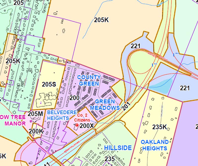
Citizens Fire Company – Fire Boxes
This map shows the Fire Boxes for Citizens Fire Company. Also included are structure locations, subdivision names, and points of interest. The map at full size is 36x54in.
Author
Jefferson County GIS/Addressing Office
Date Published
February 2019
Download PDF Map
Independent Fire Company – Fire Boxes
This map shows the Fire Boxes for Independent Fire Company. Also included are structure locations, subdivision names, and points of interest. The map at full size is 27x39in.
Author
Jefferson County GIS/Addressing Office
Date Published
February 2019

Download PDF Map
Blue Ridge Fire Company – Fire Boxes
This map shows the Fire Boxes for Blue Ridge Fire Company. Also included are structure locations, subdivision names, and points of interest. The map at full size is 36x54in.
Author
Jefferson County GIS/Addressing Office
Date Published
February 2019

Download PDF Map
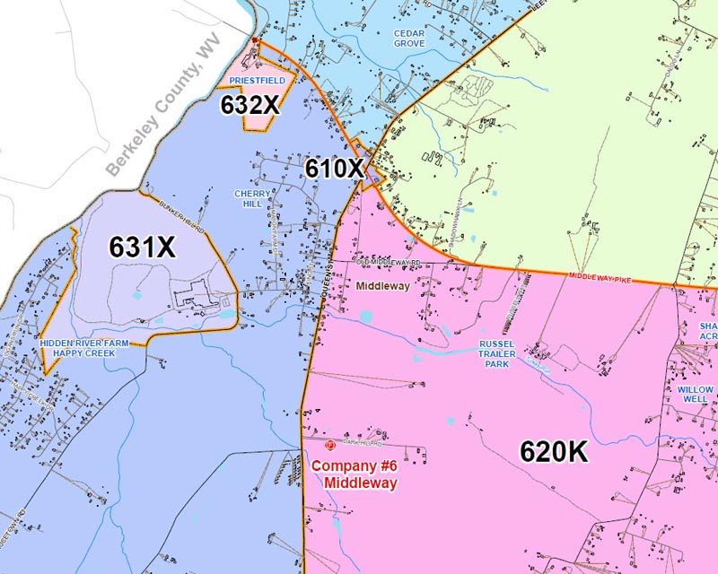
Middleway Fire Company – Fire Boxes
This map shows the Fire Boxes for Middleway Fire Company. Also included are structure locations, subdivision names, and points of interest. The map at full size is 32x51in.
Author
Jefferson County GIS/Addressing Office
Date Published
February 2019
Download PDF Map
Bakerton Fire Company – Fire Boxes
This map shows the Fire Boxes for Bakerton Fire Company. Also included are structure locations, subdivision names, and points of interest. The map at full size is 36x50in.
Author
Jefferson County GIS/Addressing Office
Date Published
February 2019

Download PDF Map
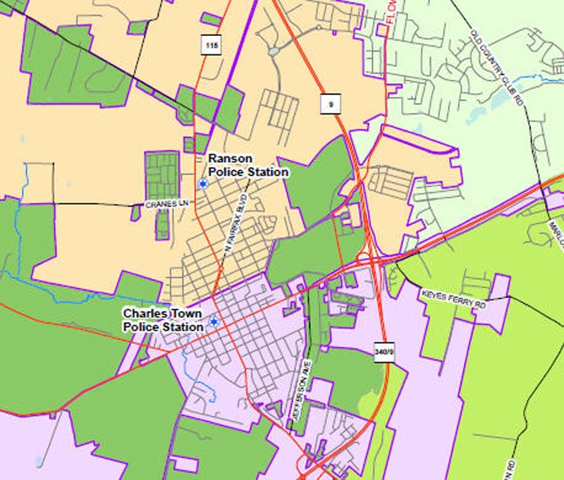
Law Jurisdiction Areas – Jefferson County
This map shows the Law Jurisdiction Areas for Jefferson County. These areas are based on 1st responders. The map at full size is 36x54in.
Author
Jefferson County GIS/Addressing Office
Date Published
August 2024
Download PDF Map
Geology / Geography
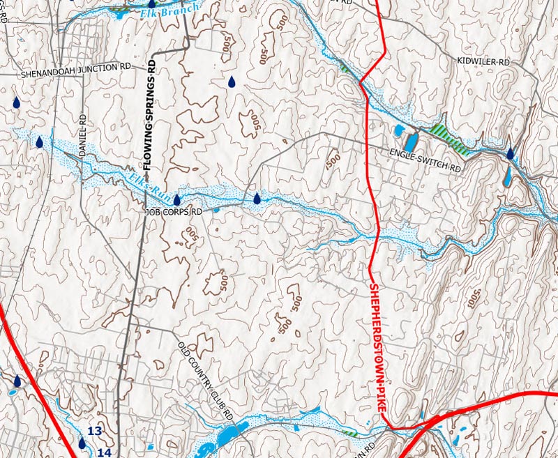
Hydrologic Map – Jefferson County, WV
This map contains all water features in Jefferson County, including rivers, streams, and springs. It also contains floodplains, wetlands, and topographic contours. The map at full size is 34x44in.
Author
Jefferson County GIS/Addressing Office
Date Published
April 2023
Download PDF Map
Elks Run Watershed
This map contains structure locations and other data within the Elks Run Watershed, Jefferson County, WV. The map at full size is 11x17in. Click here to visit the Elks Run Watershed website.
Author
Elks Run Study Committee
Date Published
May 2009
View Studies
2008 Cropland Data Layer Jefferson County, WV
This is an example map of the 2008 Cropland Data Layer for Jefferson County, WV. The map at full size is 8.5x11in. Click here to visit the NASS Cropland Data Layer website. Click here for the new interactive CropScape map.
Author
USDA – National Agricultural Statistics Service
Date Published
2008
View Studies
Chesapeake Bay Watershed
This map shows the location of Jefferson County, WV within the Chesapeake Bay Watershed. The map at full size is 8×10.5in. Click here to visit the Chesapeake Bay Program website.
Author
JC GIS/Addressing Office; Chesapeake Bay Program
Date Published
2008

Download PDF Map
USGS Scientific Investigations Report 2009-5145
This report contains a map which shows the Watersheds and Springs in Jefferson County, WV. Also included are flow measurements for each. Click here to visit the USGS website.
Author
USGS
Date Published
November 2007

View Report
USGS Open-File Report 2005-1407
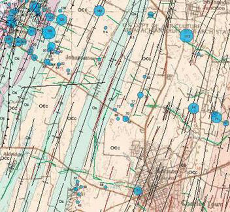
This report contains a map which shows the results of single-well aquifer tests and lineament analysis for Jefferson County. Click here to visit the USGS website.
Author
USGS
Date Published
2005
View Open-File Report
USGS Open-File Report 02-437
This report contains two maps for the Frederick Quadrangle: a geologic units map and a land cover map. Click here to visit the USGS website.
Author
USGS
Date Published
2002

View Open-File Report
Government
Census
2010 Census Block Maps
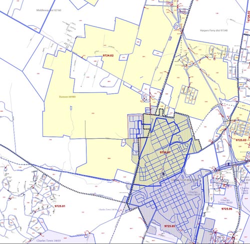
These maps depict the 2010 Census Blocks along with various base data, including municipalities and roads. Maps at full size are 36x33in. Click here to visit the US Census Bureau website.
Author
US Census Bureau
Date Published
April 2011
View Index
2000 Census Block Maps
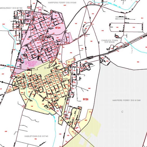
These maps depict the 2000 Census Blocks along with various base data, including municipalities and roads. Maps at full size are 36x33in. Click here to visit the US Census Bureau website.
Author
US Census Bureau
Date Published
December 2001
View Index
1990 Census Block Maps
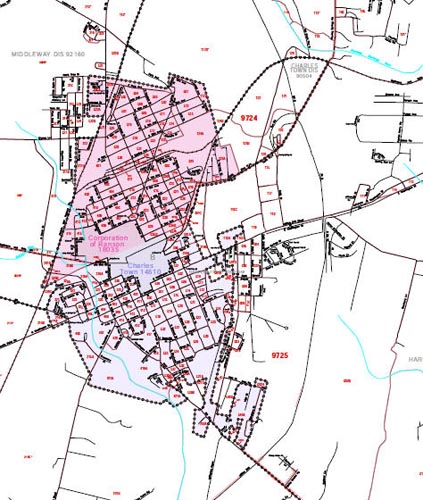
These maps depict the 1990 Census Blocks along with various base data, including municipalities and roads. Maps at full size are 36x33in. Click here to visit the US Census Bureau website.
Author
US Census Bureau
Date Published
October 2002
View Index
Government
Election Districts
Current Election Precincts – Jefferson County (Interactive)
This interactive map contains all precincts/polling locations. A variety of other information is included. Please note: This map is for reference only and is not an authoritative source. For questions, please contact the Voters Registration Office at 304-728-3246.
Author
Jefferson County GIS/Addressing Office
Date Published
December 2021

Map Link
Magisterial Districts and Voting Precincts – Jefferson County
This map contains the current election districts, voting precincts, and polling locations for the entire county. The map at full size is 36x48in.
Author
Office of Planning/Zoning & JC GIS/Addressing Office
Date Published
July 2022

Download PDF Map
Government
Planning & Zoning
Future Land Use Guide
This map was created as part of the Envision Jefferson 2035 Comprehensive Plan. The map at full size is 36x54in. For more info about the map or the plan, contact the Jefferson County Office of Planning & Zoning.
Author
Office of Planning/Zoning & JC GIS/Addressing Office
Date Recorded
February 14, 2015 (Plat Book: 25, Page: 494)
Date Published
February 13, 2015

Download PDF Map
2025 Zoning Map, Jefferson County, WV
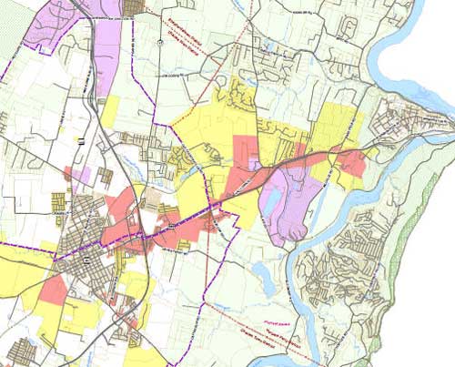
This map was created as part of the Envision Jefferson 2035 Comprehensive Plan. The map at full size is 36x54in. For more info about the map or the plan, contact the Jefferson County Office of Planning & Zoning.
Author
Office of Planning/Zoning & JC GIS/Addressing Office
Date Recorded
February 14, 2015 (Plat Book: 25, Page: 494)
Date Published
February 13, 2015
Download PDF Map
Cell Tower Locations
This map contains the locations of all known cellular mounted assets as of October 2023. The map at full size is 11x17in. For more info, contact the Jefferson County Office of Planning & Zoning.
Author
Office of Planning/Zoning & JC GIS/Addressing Office
Date Published
2023

Download PDF Map
Subdivisions & Mobile Home Parks – Jefferson County
This map contains the locations of all known cellular mounted assets as of October 2023. The map at full size is 11x17in. For more info, contact the Jefferson County Office of Planning & Zoning.
Author
Office of Planning/Addressing Office
Date Published
December 2023

Download PDF Map
Subdivision Development Patterns – Jefferson County
This map shows growth by decade in Jefferson County from 1972-2008. The map at full size is 11x17in.
Author
Office of Planning/Addressing Office
Date Published
August 2008

Download PDF Map
Halltown Study Area – Jefferson County
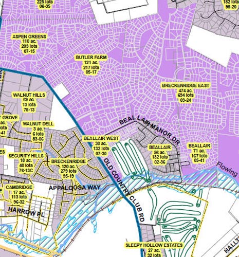
This map shows the existing and future development of the Halltown Area in Jefferson County. The map at full size is 11x17in.
Author
Office of Planning/Addressing Office
Date Published
August 2008
Download PDF Map
Population Growth in West Virginia
This map depicts the population growth in West Virginia from 2000-2007. The map at full size is 8.5x11in. For more info, contact the Berkeley County Planning Dept.
Author
Berkeley County (WV) Planning Dept
Date Published
July 2008

Download PDF Map
Have Questions?
Contact the Office of Planning & Zoning to learn more. We’re happy to help!
Phone
304-728-3228
Address
116 E. Washington Street, Suite 200
Charles Town, WV 25414
planning@jeffcowv.gov
zoning@jeffcowv.gov
Hours
Monday-Friday: 9:00 am – 5:00 pm